| |  | | | |
|---|
 | | | 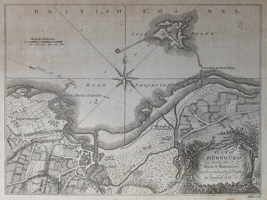 | Plan of Cherbourg with the Ports & Batteries when taken by the English in August 1758
Ref: P/4578
Region: Cherbourg
Type: Copper
Engraver: Hilton
Date: 1758
 |
| |
| | |  | | |
| | |  | | |
 | | | 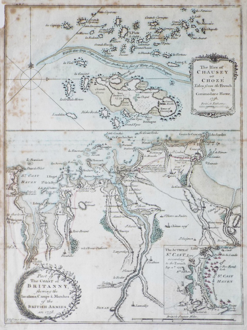 | Part of the Coast of Britanny, shewing the Invasions, Camps & Marches of the British Armies in 1758.
The Isles of Chausey or Choze Taken from the French by Commodore Howe, 1756
Ref: P/23380
Region: Saint-Malo
Type: Copper
Engraver: Jefferys T
Not for sale |
| |
| | | 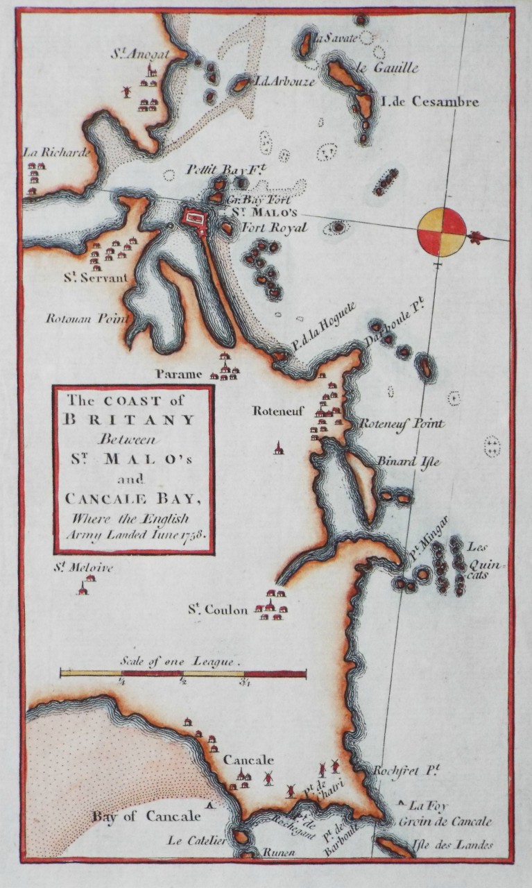 | The Coast of Britany Between St. Malo's and Concale Bay, Where the English Army Landed June 1758.
Ref: P/24069
Region: Saint-Malo
Type: Copper
Date: 1758
Not for sale |
| |
| | | 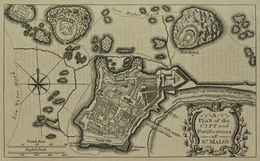 | A Plan of the City and Fortifications of St. Malo's
Ref: P/11423
Region: Saint-Malo
Type: Copper
Date: 1758
Not for sale |
| |
| | |  | | |
| | | 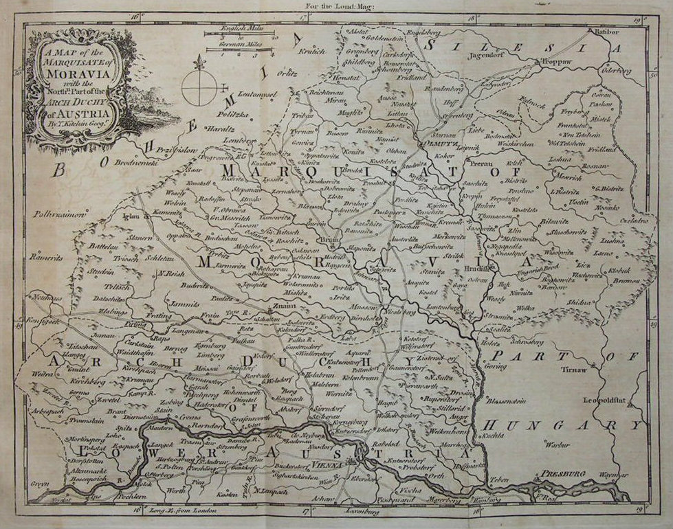 | A Map of the Marquisate of Moravia with the Northn. Part of the Arch Duchy of Austria
Ref: P/5205
Region: Moravia
Type: Copper
Cartographer: Kitchin T
Date: 1758
|
| |
| | |  | | |
 | | |  | | |